

And Lo! The Mountains Hid Themselves From My Eyes
From Devils Tower to Grand Teton: Adventure, Peril, and Discovery.

This is a free post made possible by paid subscribers.
Writing is my profession and calling. If you find value in my work, please consider becoming a subscriber to support it.
Already subscribed but want to lend additional patronage? Prefer not to subscribe, but want to offer one-time support? You can leave a tip to keep this project going by clicking the link of your choice: (Venmo/Paypal/Stripe)
Thank you for reading, and for your support!
I was feeling pretty good as I left Devils Tower, headed west.
I had nearly forgotten to make the stop, remembered just in time, had an amazing afternoon, and would rank the tower as one of my favorite places I’ve ever visited in nature. It was a pure win.
But now I had to deal with the fact that I wasn’t getting to the Tetons until well after dark, so I needed a place to stay that wasn’t crazy far, and wouldn’t land me there too long after dark. A little research identified Cody, Wyoming, as the place to stay. It was 300 miles away — about a 5 hour drive — and that meant I should be able to get there before 9PM.
I fired up my app that finds last-minute hotel deals, and got a killer price on a place right in town. It was about half as much as anything else in Cody, and the reviews were great.
Another score.
So I made my way back out to the interstate, and hit the gas.
There wasn’t much to look at for the first half of the drive. This was open sky country, and the landscape was nothing but dry, brown, high-plains steppe. Gently rolling hills and flat valleys and visibility for 10-20 miles in every direction.
But then, I crested a small hill on the interstate, and something far more interesting came into view: the Bighorn Mountains, huddled beneath clouds that looked like they might be gathering for a storm.
I pulled over, and grabbed my drone. This was the kind of scenery I’d been looking for. Big. Open. Almost alien.
I jumped back in and looked at the GPS, only to realize that I was almost on top of my exit. I was supposed to get off in a town called Buffalo, and then take route 16 from there.
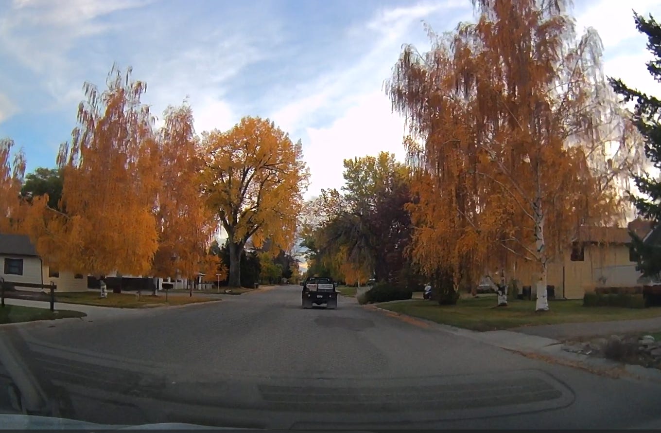
I drove through the small town, just as the sun was dipping behind the horizon. The fall colors there were at their peak, brilliant highlighter yellows and neon oranges decorating the streets.
I didn’t have much time to stop and admire though, because it was going to be dark soon. And although I didn’t realize it until a few minutes after I’d taken the image above, I was about to be driving through the mountains.
Route 16 takes you out of Buffalo and over the Bighorn Mountains via the Cloud Peak Skyway. At its highest point — Powder River Pass — the road reaches an elevation of 9,666 feet above sea level. The steepest road grade is about 7-8% — not terrible — but there are long sections of sustained uphill slog, and as it turned out, that was a problem for my little car.
Now, I’d been getting intermittent “Engine Coolant Overheat” warnings since I first got the car, usually when accelerating up an on-ramp onto the interstate. But the warnings would go away immediately once I leveled out, and I’d been having some other sensor and electrical issues, so I hadn’t been sure what to make of it. After troubleshooting the error with AI, I’d purchased an inexpensive OBD scanner that connects to my phone via Bluetooth. Just plug it into the port under the driver’s side dash, fire up an app, and you can see lots of interesting data about your car; including the reason for any check-engine lights. Every time I got an overheat error, I pulled out my phone, checked the coolant temp, and saw that it was within spec. It only happened a few times over thousands of miles of driving, so I had long since stopped worrying about it.
But this hill was different. It was only moderately steep, but it just kept going up.
After a couple of miles of this scenery, I got my first engine overheat warning.
Believing it was a bad sensor wire, I ignored it.
But then it pinged again. It had never done it twice.
Then a third time. But this time, all of a sudden, the engine cut out.
And I smelled something burning.
As you can see from the video, there’s not really any shoulder on this road. Not wide enough to get your car out of the lane. The sky was overcast and it was getting darker by the minute. And when I looked at my phone, I had no cell signal at all.
The app on my phone told me the coolant temp had gotten all the way up to 224 degrees Fahrenheit. It also said a system event had killed power to the engine to protect it. To my mind, that was a good sign. It meant I just needed to give the engine time to cool off, and maybe I could start it up again.
I coasted into an area with a slightly wider shoulder, pulled over, and shut everything off. I waited five minutes. Ten. I needed to use the restroom, and I was in a wide open stretch of road that, while not quite busy, still had enough traffic that I would have preferred a bit of privacy. I checked the app. The engine had dropped back down to 212 degrees, but it was staying steady there. I knew I needed to get the vehicle moving to get airflow to help cool it off — especially because the temperature outside was dropping into the low 40s at this point — but it was a Catch-22. If I had to keep driving uphill, I might just make it worse. And I didn’t want to blow the head gasket. I was not in the market for a full engine replacement on a car I’d only had for a few weeks.
I decided to give it a try, and the engine started right up. The temperature stayed where it was. Normal operating temperature for the car is about 175-205, depending on how much strain the engine was under, and I was still above that. I limped it along up the hill, keeping my eye on the app’s temperature gauge the whole time. I finally found a pull-over area and decided to give her a longer rest. Popped the hood so the heat could better dissipate. Grabbed my drone and used the time to get some better shots of the mountains — the ones you see at the end of the first video I posted above.
I had a dilemma. I’d booked a non-refundable room for the night that was still several hours away. I’d barely seen cell signal all day, and in these mountains, it was totally non-existent. If the engine problem got worse, I was out of luck. I could turn around and coast back down the hill that had done me in and try to find a place to stay in Buffalo and get the car looked at, but all I saw were dollar signs. It was the weekend. I was in rural Wyoming. Buffalo has a population of fewer than 5,000 people. Anything I did there was going to be expensive and likely involve long delays. If they had to order parts, it might take days.
Or I could bet on the idea that I had a bad thermostat that was getting stuck, letting the engine temps climb higher and faster than they should. I wasn’t leaking fluid. The burning smell had dissipated, so it was likely something that vented and burned off. I could keep the windows down, despite the cold, and crank the heater to help vent the excess heat. That would also keep the fans blowing air over the engine compartment.
I decided to risk it. Getting stuck there felt like it could kill the momentum of this leg of the trip. The solo part. The deep dive into dealing with myself, my pain, my identity, and my future — with no distractions.
Carefully, slowly, I proceeded. I watched the app like a hawk, and the temps would climb up to about 205, then drop into the 190s when I’d hit a downhill slope and get some relief. I nursed it along, all the way past the nearly 10,000ft mark at the top of the pass. I was bummed at how fast night had closed in — I wanted to see this scenery, and I’d blown the last half hour of daylight trying to get poor Evie to cool down.
Yes, I name my cars. I’d been calling this one “Escape Pod 1,” but in a strange moment, I caught myself calling her Evie, for no obvious reason, then saw the acronym come together in my head: “Escape Vehicle 1 = EV1 = Evie.” And I knew at that moment it was going to stick.
So we drove through that night, as a darkness fell that was so deep it felt like existence was constrained merely to what could be seen within the visible circumference of the headlights.
There had been a book I’d planned on listening to, but because of the lack of data connectivity throughout the state, it had never downloaded to my phone. It was too quiet, and I needed something to take my mind off the obsessive worry I had over whether I was making things worse by continuing. I couldn’t stream anything, so I looked for something in my phone that was already downloaded.
And then I saw it: Greenlights, the memoir/autobiography written and read by Matthew McConaughey.
I’d listened to this book for the first time in 2019 or so, and I’ll be honest, it was so much better than I’d expected. I loved McConaughey’s stories about growing up, the wild love between his parents, the realities of “outlaw logic,” the rites of passage he and his brothers had to go through with his dad, all of it. It gave me a new perspective on what it means to really live, and I’d listened to it a second time a couple years later.
I was on my third listen, and less motivated this time, but I thought at this season of my life, it might hit me differently than it had before everything had gone tits up. On and off, I’d listen to a chapter here and a chapter there, but I was currently in my least favorite section of the book, which was about McConaughey’s year as an exchange student in Australia, just after graduating high school back in Texas. He had been assigned an exceedingly strange host family, and they made his life difficult in ways that were just personally awkward and uncomfortable for me to listen to. But I didn’t have any other good options that were going to keep me awake, so I dove in anyway.
I coasted down the other side of the mountains, McConaughey’s mischievous drawl in my ears, watching the engine temp come down to exactly where it should be, downshifting into lower gears as I went to take the load off the brakes. After what felt like hours, I finally found myself back on flat road.
I was dog tired, but I still had over a hundred miles to go.
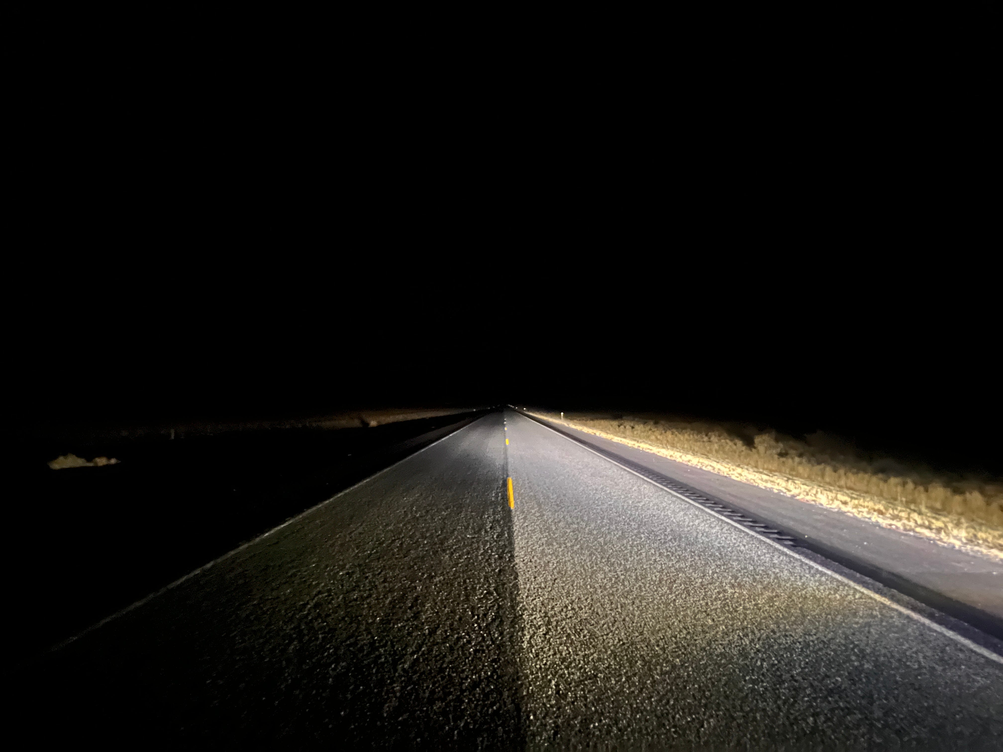
So I kept going. At one point, on a stretch of road so pitch black and so barren I had no idea whatsoever what kind of scenery might exist on either side of the asphalt, I stopped in the road to take a photo. The speed limit here was 70mph, but the road had been a flat ribbon of pavement for so long, I was confident I could see anyone coming long before they presented a danger.
I got out, and snapped a photo. Most of the night looked exactly like this:
At some point, around the conclusion of his Australian adventure, McConaughey reflected on what he’d learned from a torturous year staying with a crazy family, and it hit me right between the eyes:
Yeah, I was forced into a winter. Forced to look inside myself because I didn’t have anyone else. I didn’t have anything else. I’d lost my crutches. No mom and dad, no friends, no girlfriend, no straight A’s, no phone, no truck, no “Most Handsome.”
And I had a curfew.
It was a year that shaped who I am today.
A year when I found myself because I was forced to.
A year that also planted the seeds of a notion that continues to guide me: Life’s hard. Shit happens to us. We make shit happen. To me, it was inevitable that I was staying the entire year because I’d shaken on it. I’d made a voluntary obligation with myself that there was “no goin back.” So I got relative. I denied the reality that the Dooleys were off their rocker. It was a crisis. I just didn’t give the crisis credit. I treaded water until I crossed the finish line. I persisted. I upheld my father’s integrity.
And while I was going crazy, I kept telling myself that there was a lesson I was put there to learn, that there was a silver lining in all of it, that I needed to go through hell to get to the other side, and I did. We cannot fully appreciate the light without the shadows. We have to be thrown off balance to find our footing. It’s better to jump than fall. And here I am.
Greenlight.
And there it was. Another big breadcrumb dropped right into my lap.
I have a tendency to get really upset when things go sideways. I catastrophize. I overreact. Under stress, my brain wants to shut down. My wife, always the cooler head and better problem solver in the relationship, has often had to find the way through. It’s one of the kinds of things I’ve left to her that she always wanted me to handle, at least some of the time, because it was supposed to be my job. I’m the man. I’m supposed to take point.
I’ve traced some of these behaviors back to aspects of my childhood, and I can see why they took root there.
But they no longer serve me.
McConaughey’s recap of his lessons learned from his Australia trip sounded eerily like what I was experiencing not just since leaving home, but particularly during that night, in that moment. I realized that even a month ago, if my car had overheated in the mountains in the middle of nowhere as darkness fell, and I had no cell signal, I would have lost my shit.
But I didn’t, this time. I handled it. Not without worry or anxiety, but calmly. I never yelled. I never slammed my hands on the steering wheel. I never shook my fist at the sky and asked why this was happening to me. I thought it through. I found a solution. I made a decision and committed to it.
I didn’t freeze.
Hell, I wouldn’t even have been listening to that book if the one I’d wanted to listen to had finished downloading, like I’d set it up to do. And I wouldn’t have been listening if I’d decided to turn around and go back to Buffalo. I only put it on to get me through the mountains and keep my mind from dwelling overly much on what might still go wrong.
Everything about that night culminated in that specific realization — that I was “forced to look inside myself because I didn’t have anyone else” and had come out the other side. And it was taken from a book I’d owned for years and already read twice.
I’d just never needed to hear that part in that way before. Not like I did that night.
Greenlight indeed.
The rest of the trip to Cody was uneventful. The car temps stabilized. The burning smell was completely gone.
I got to the hotel not long before the front desk closed and checked in.
“Now,” the clerk asked, “are you planning on going to Yellowstone tomorrow?”
“Why?” I asked.
“Because they just closed the road. There’s a winter storm coming in.”
Now, I hadn’t planned on going to Yellowstone, but the route to Grand Teton National Park was largely the same.
Had I survived the evening’s ordeal only to hit another closed door? I was starting to think so.
I brought my stuff to my room, and seeing that it had a microwave, decided to pick up some food from the local grocery store. Heat and eat-type stuff It didn’t turn out to be much cheaper than going out, but I was tired and wanted to kick back and watch a movie, which is exactly what I did.
And then I got some much-needed sleep.
The Tetons, They Are Grand
In the morning, I ate some meager leftovers from the previous night’s dinner and a couple of hard boiled eggs I’d bought in a plastic pouch, then washed it down with some cheap hotel room coffee-maker joe.
It was less food than I’d planned on having, but it was going to have to do. I not only had to find my way to my destination, I had to figure out what I was going to do after it. I had not yet found a place to stay for the night, and wasn’t even sure where I might wind up when the day was done.
I went out and made all the checks on the car that I’d looked up to make sure the head gasket wasn’t leaking. No milky oil on the dipstick or the engine-oil cap. No fluid on the ground. Coolant above the fill line. No visible spillage in the engine compartment. No white smoke on startup. It seemed like, if those were the indicators I was looking for, Evie had avoided the worst outcome.
I went back to my room and looked at the map. It looked like the best way to go, all other things being equal, was through part of Yellowstone, around Yellowstone Lake, then South. That route was a total of about 90 miles. But my GPS wanted to take me the long way around, adding an extra 200 miles to the trip, and it wasn’t telling me why. It wasn’t even giving me the option of the shorter route. Were there storms still in the mountains? Was it something else? I’d downloaded the Wyoming 511 app, which was supposed to give me road information, but from what I was seeing, it looked like all the routes I was considering were dry, not snow-covered.
I asked ChatGPT to help me figure out which way to go. There’s no way, on a navigation app, to avoid steep mountain roads, so I had it look at the available data on the highways I was considering. It told me that the shorter route, the one I wanted to take, had some of the steepest roads on any American highway.
Long way it is, I thought.
I straightened up my car, threw away trash, and checked out, then headed into town to get a cup of stronger, better coffee. Then it was back on the road again.
It was an interesting trip, through a lot of different kinds of terrain. Early on in the drive, I could see snow-capped mountains off to my North, but my route was taking me South and West and I never got close enough to give them a good look. The rolling brown steppe gave way to rocky formations, river valleys having spent millions of years carving out canyons perfect for building roads within. These gave way to more flat plains, then red rocks, as the temperature kept dropping and I started seeing the first signs of snow.
Here’s some footage of that leg of the drive. The diversity of Wyoming’s landscape is impressive:
As I started making my way into the area near the Grand Tetons, the conditions got dicey. Temperatures outside dropped below freezing, and I was now dealing with climbing extended grades covered with snow — not excessively steep, but enough to make my coolant temp start climbing. It was a four lane road in many places, but only the interior lanes were plowed. The road was a mix of slush and wet asphalt, which I fully expected to ice as the outside thermometer dropped into the 20s.
At long last, I made it into the park. There was almost nobody there. There was an active winter storm warning, a government shut down, snow falling, and freezing temperatures. It felt abandoned.
Making matters worse, there was a heavy cloud cover that was hanging low over the park like fog. I couldn’t see the mountains anywhere. I didn’t even know where to go look for them. I had assumed that when I got there, they’d be hard to miss, but visibility was severely limited.
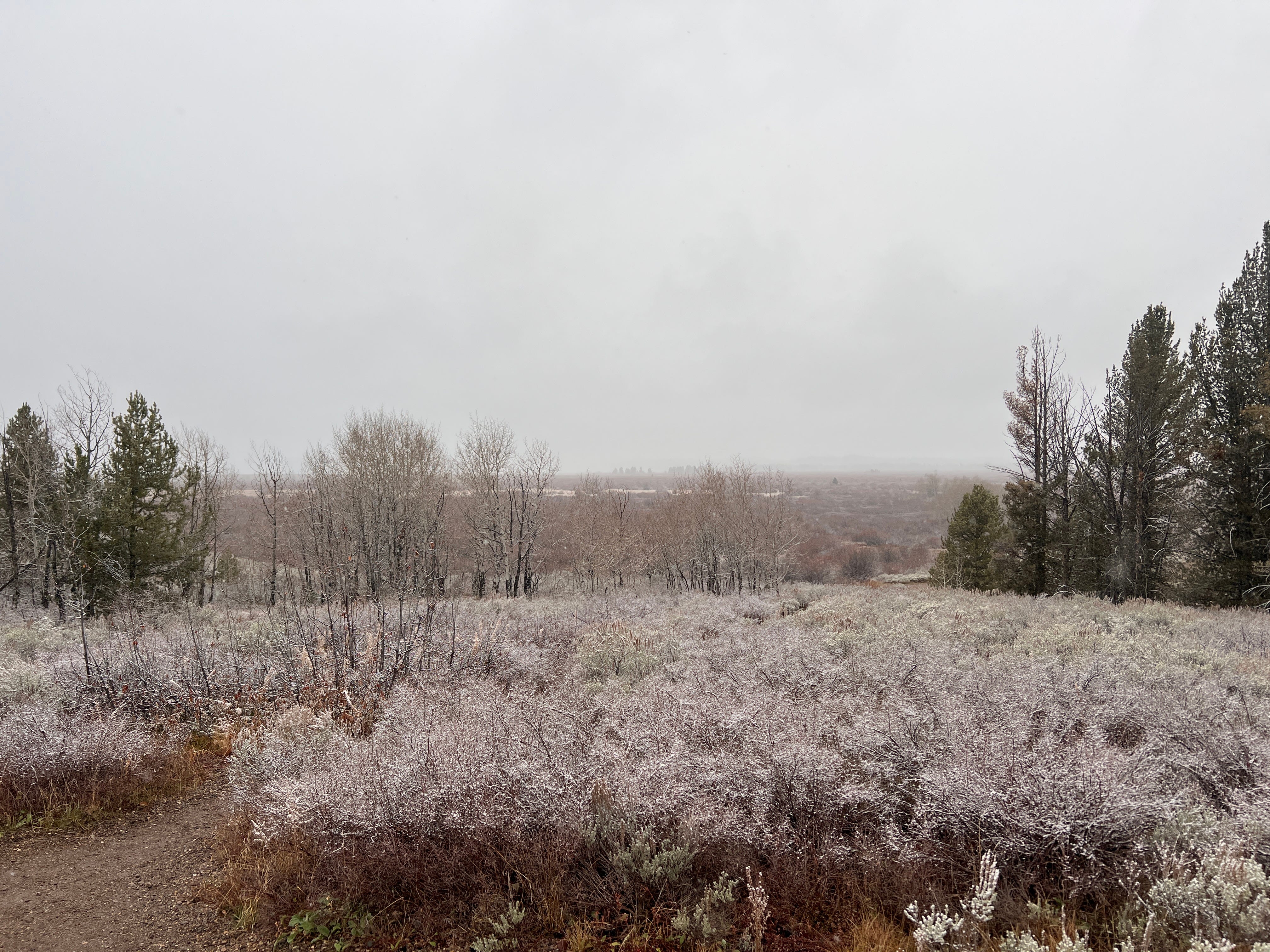
I had Colter Bay Village — one of the main developed areas inside the park — set in my GPS. From what I’d seen, it had a great view of the mountains, but when I got there, all I saw was more clouds and a bunch of closed down facilities.
I’d driven miles through the park, and I’d seen nothing but trees and frosted grass. I was starting to have to come to terms with the fact that I may have come all that way to not see anything.
I was seriously bummed.
For whatever reason, Grand Teton National Park was sort of my internal North Star for the whole trip out West. It was the one place I hadn’t been to before that I knew for sure I wanted to see. Every park further West was one that I’d either visited years earlier, or hadn’t been to but would have been OK with not seeing if plans changed.
Frustrated, I killed the GPS, only to discover that the 3G signal I was seeing on the phone was not broadcasting any data. I couldn’t put a destination in. I was going to have to navigate my way back out of the park in the snow with no GPS, no map, nothing but road signs.
Deep breath.
I started retracing my route, trying to find my way back the way I came. Somewhere along the way, I saw a sign pointing in the direction of Jackson, one of the towns I knew by name was close to the park. I turned and headed that way. It was a beautiful day, despite the low visibility, and I was grateful to be seeing the snow. I just wished I could get a glimpse of the mountains I’d come to see.
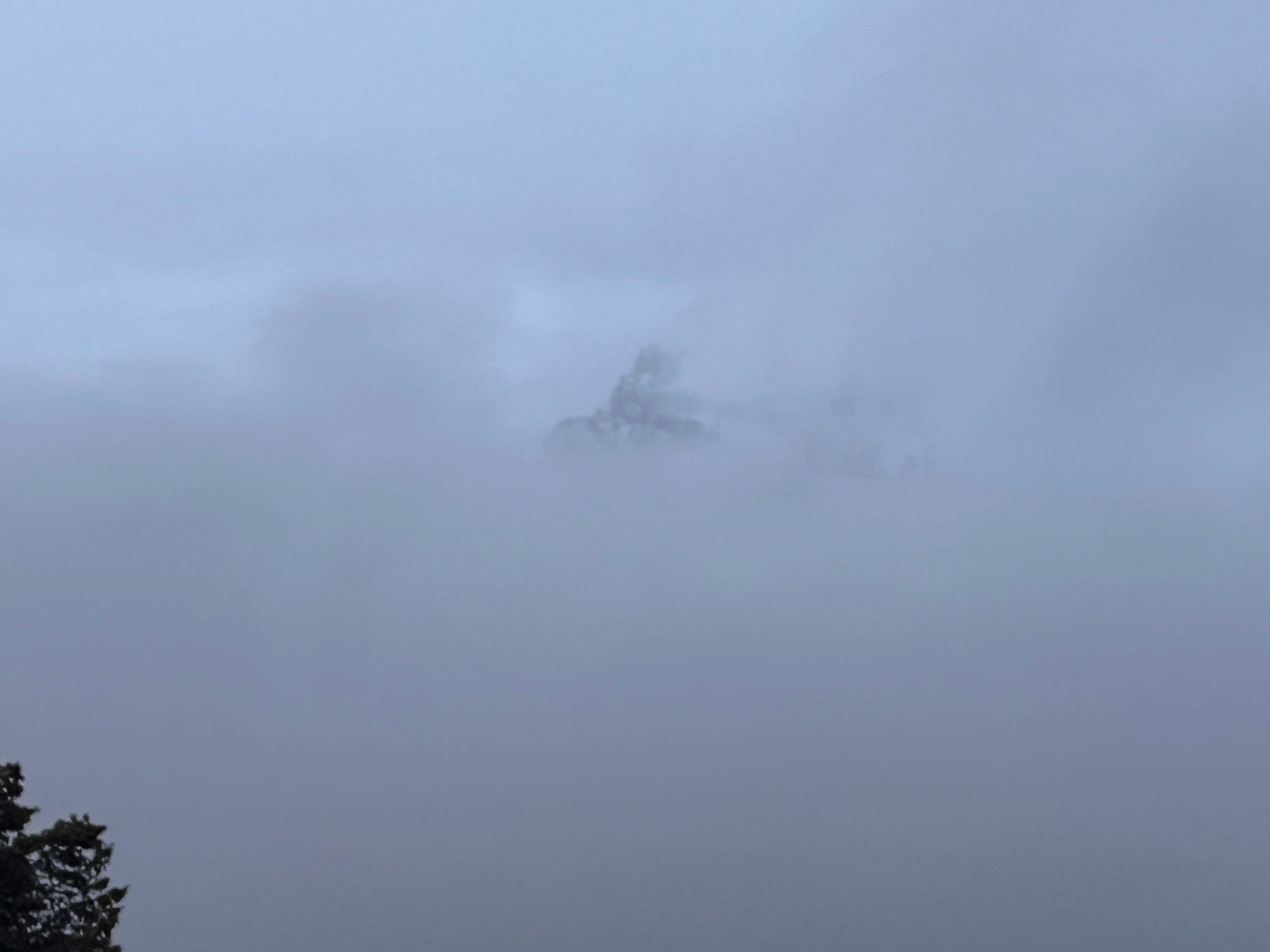
And then, down a long stretch of road, I saw some people stopped in a parking area who were out taking photos. I pulled in, and sure enough, through the fog, I could just barely make out the shape of the mountains.
They were massive.
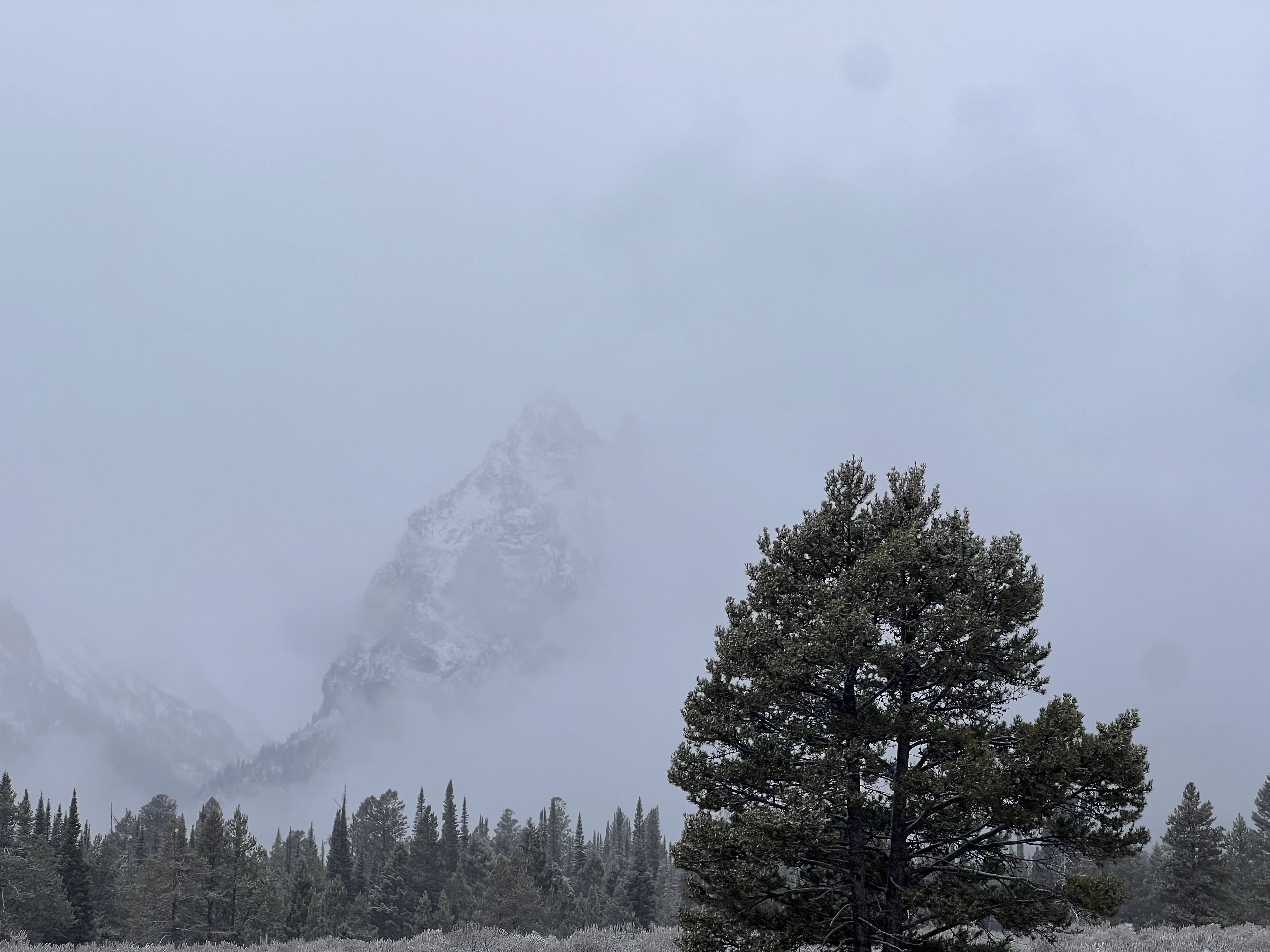
I waited in that spot for a while, watching the fog and the clouds move by. I took photos every time the peaks began to appear through the mist. I grabbed a video with my phone that perfectly captured the elusive visuals:
Here’s another:
It was frustrating not being able to get a clear view, but to be honest, in a way, what I saw was far more beautiful and mysterious than I could have hoped for on a clearer day. It felt almost symbolic, the way the heart of this voyage, the touchstone I most ardently wanted to connect with, was shrouded in a way that its full meaning was obscured.
Wasn’t this exactly the way the whole trip had gone? I’d left to go find something — maybe answers, maybe perspective, maybe myself, maybe all of it — and I would not return empty handed, but the meaning of all that I had encountered along the way was not yet clear. Would not be, likely for some time to come, if ever.
I waited. I drove a little. I took more photos. I tried to capture the beauty as best I could within the limitations imposed by the weather.


The sky was beginning to darken by this point, and I realized I’d seen all I was going to. I continued on the road heading towards Jackson, hoping for but never managing to find a better view.
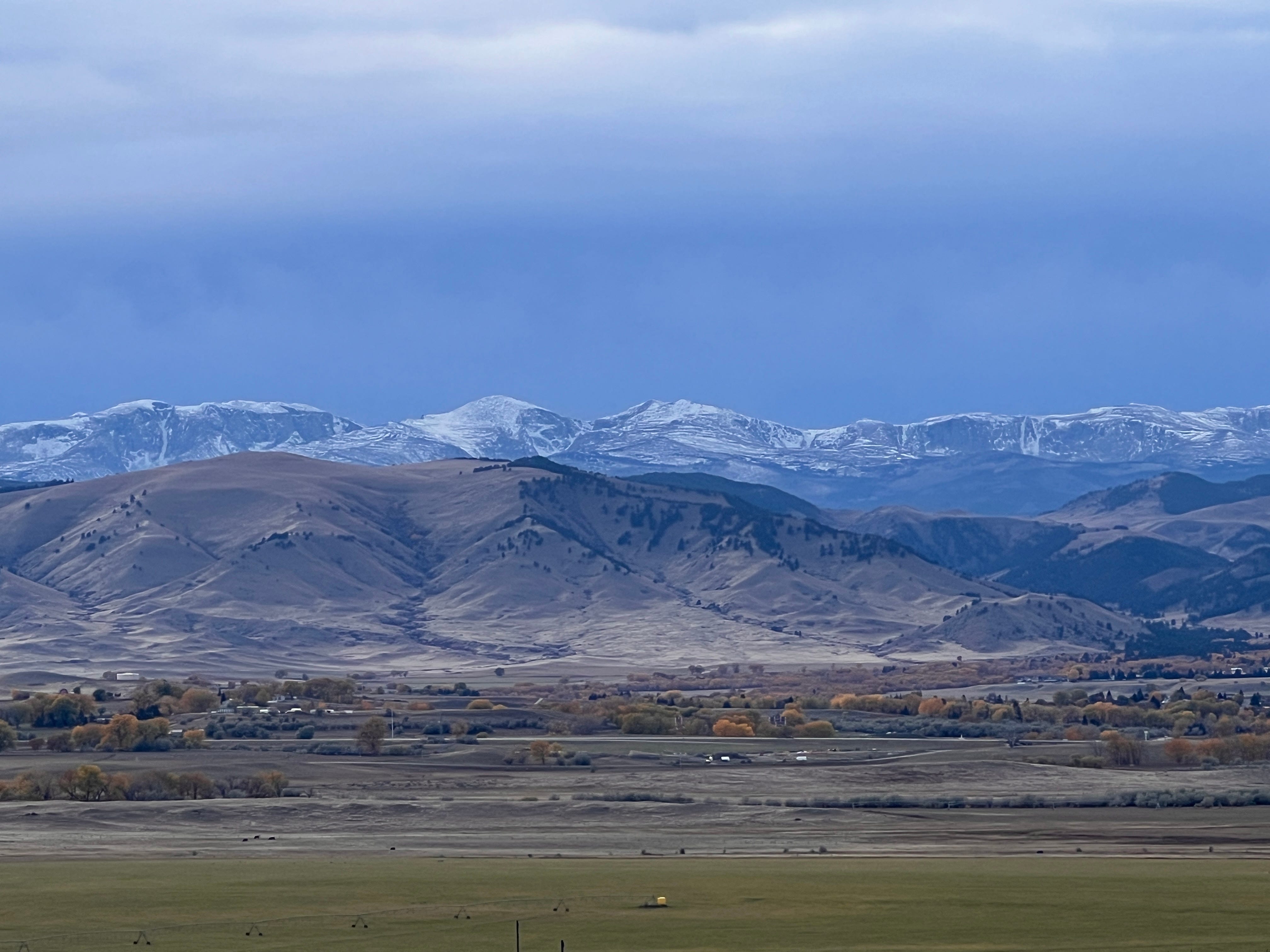
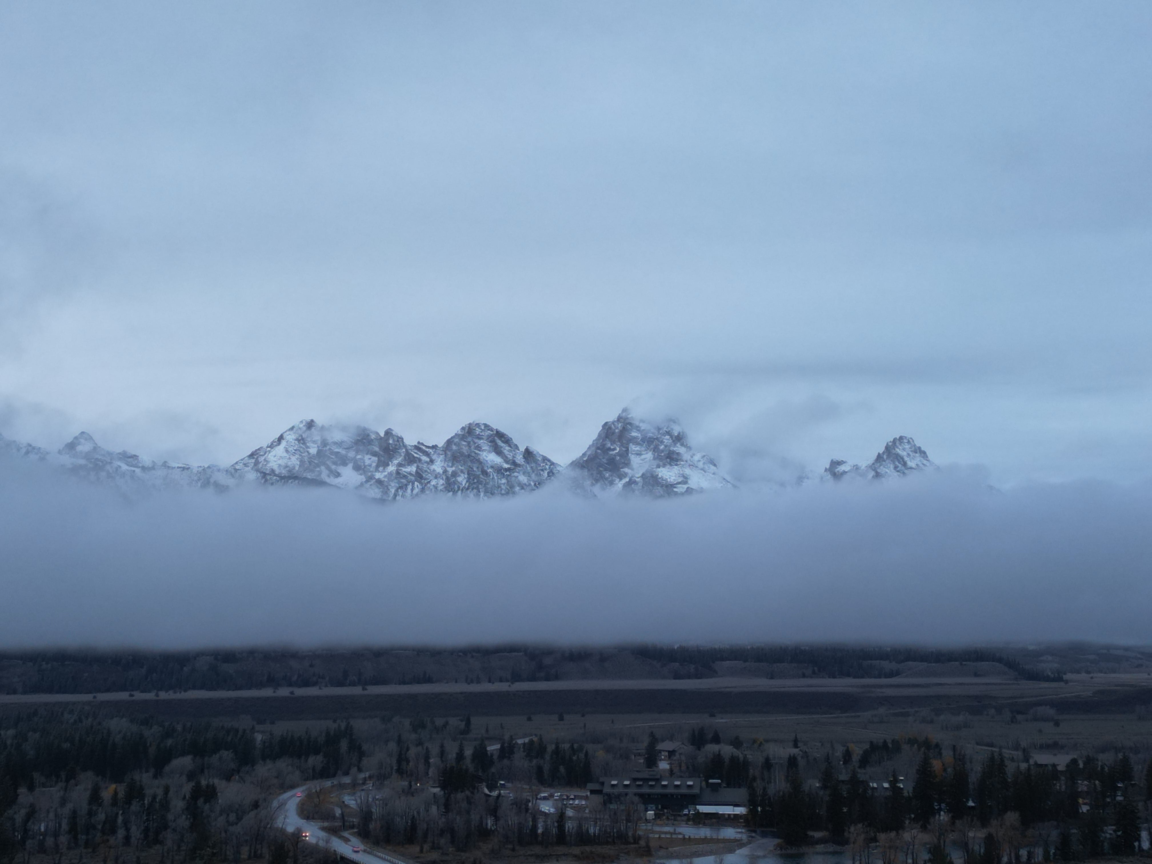
Eventually, I got to the far end of the park, and after passing the entrance gates and finding my way out to the nearby highway, I turned and saw the very crest of the Tetons above the clouds. Safely outside the park itself, where I was pretty sure it was legal to fly, I got my drone out for one last shot. I was going to make the most of this before I lost the light.
The trip into and through the park looked a little something like this. Stick around until the end to get the drone shots of the mountains through the fog:
By the time I got my last shot, I was freezing, and it was getting darker by the second. I drove the remaining 30 miles or so into Jackson, and looked for a place to stay.
But everything there was way too expensive. I hadn’t paid more than $80 for a hotel or AirBnb since I started the trip — at the absolute maximum — and I wasn’t about to do so now.
The closest reasonable place to stay, with access to the interstate so I could figure out where to go next without crossing more high-altitude mountain passes and risking Evie’s feeble engine, was across the state line in Rexburg, just outside of Idaho Falls.
I found a place, put the destination in my finally-functioning GPS, and headed off into a dark and rainy night.
If you liked this essay, please consider subscribing—or send a tip (Venmo/Paypal/Stripe) to support this and future pieces like it.
What a great post. Glad you made it.
The Bighorns are so beautiful. And what a spectacular view you really did get of the Tetons.
If you make it back that way, the Historic Hotel Greybull in Greybull is one of the most memorable hotels I've stayed in.
This may also be the kick I need to finally read Greenlights, which I own because of how great it seemed from the excerpt I read.
Be safe.
Clouds shroud and mystery meet on the Tetons. Beautiful...